 GéoGuyane
Environmental monitoring facilities
Harvested
Provided by
Type of resources
Topics
Keywords
Contact for the resource
Provided by
Years
Formats
Representation types
Update frequencies
status
Scale
-
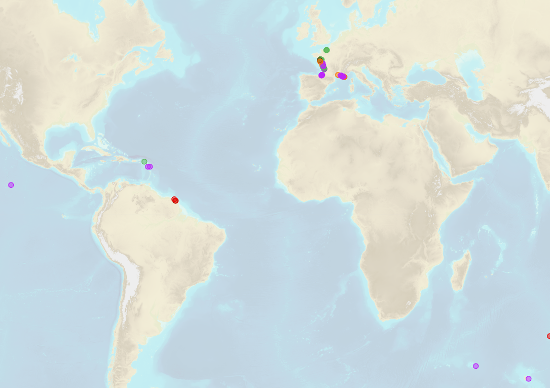
Shom is the national referent for the level of the sea in situ on all areas under French jurisdiction. In this capacity, he assures under the acronym REFMAR different coordination functions in the collection and dissemination of public data related to water level observations, in order to promote their use in multiple applications within the framework of international recommendations.
-

Shom manages a network of permanent digital coastal tide-gauges on French coasts: the RONIM Sea Level Observation Network. Most tide-gauge observatories are partnered with one or more local partners.<br /><br /> Four main types of data are available for download:<br /> - “Raw high frequency" data: raw observations neither validated nor evaluated, obtained directly from the sensor. 1-minute measurement; integration time 15 seconds (on the minute); sampling period: 1 second.<br /><br /> - "Raw non-real time" data: raw observations neither validated nor evaluated, obtained directly from the sensor. 10-minute measurement; integration time 121 seconds (around every 10 minutes); sampling period: 1 second.<br /><br /> - "Validated non-real time" data: observations checked and validated by Shom from the "Raw non-real time" data. 10-minute measurement; integration time 121 seconds (around every 10 minutes); sampling period: 1 second.<br /><br /> - "Validated hourly" data: observations checked and validated by Shom, generated from "Validated non-real time" data. Hourly measurement obtained from the Vondrak filter with triangular weighting. The hourly height cannot be calculated in the event of an observation gap greater than 1.5 hours.
-
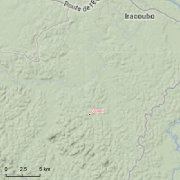
Guyadiv is a network of permanent forest plots installed in French Guiana. The site of Guyadiv in Counami is composed of 19 1200sq.m-plots. A complete inventory has been made on these plots, during 3 inventory sessions in 2000, 2001 and 2002. 1743 trees have been inventoried, with 92,2% to 100% of trees identified to species level. We only have the point coordinates and not the precise demarcation of the sample plots. In order to calculate the bounding box for these plots, we have expanded the point location 500 meters in each direction.
-
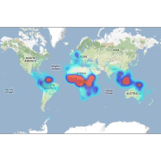
This database contains botanical records either relating to material present in one of the Naturalis collections, or to material that has been or is being used in research projects. The records usually relate to herbarium specimens, but it also contains data on silica-gel samples, wood samples, spirit collections, carpological collections, etc.; rarely to observations only. The Naturalis collections have their strong points in The Netherlands and surrounding countries, Southeast Asia and New Guinea, West- and Central-Africa, Ethiopia and the Guyanas.